Trace Labs Challenge # 9
Hey everyone — 404Yeti back again with another Trace Labs OSINT challenge.
This one looks calm and peaceful… but don’t let the clouds fool you. This is a classic low-context GEOINT problem.
Objective
Identify:
- The lake
- The geographic coordinates of the lake
Tools Used
- Google Images — reverse image searching
- Google Maps — location verification & coordinates
- Street View — ground-level confirmation
Image:
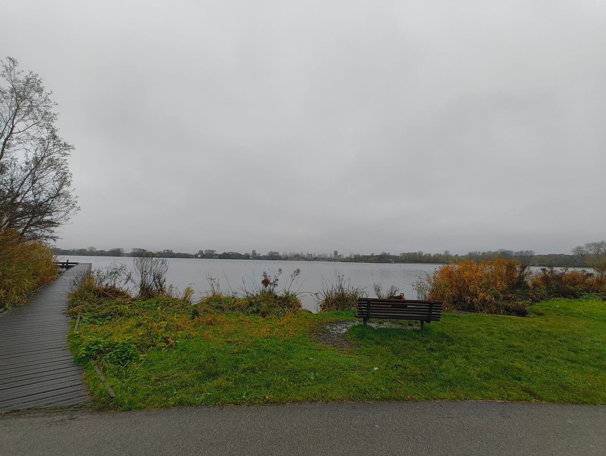
At first glance, this image gives us very little:
- Open lake in the foreground
- Grass and a walking path on the left
- Distant city skyline
- Heavy cloud cover
- No signs, no landmarks, no text
This is exactly the kind of image that rewards patience and reframing.
Step 1: Reverse Image Search

We upload the image to Google Images.
Initial Result
We get a flood of:
- Generic lake photos
- European cityscapes
- No exact match
This tells us:
❌ The lake itself isn’t famous enough
✅ The context is what matters
Step 2: Reframe the Search (Background Focus)
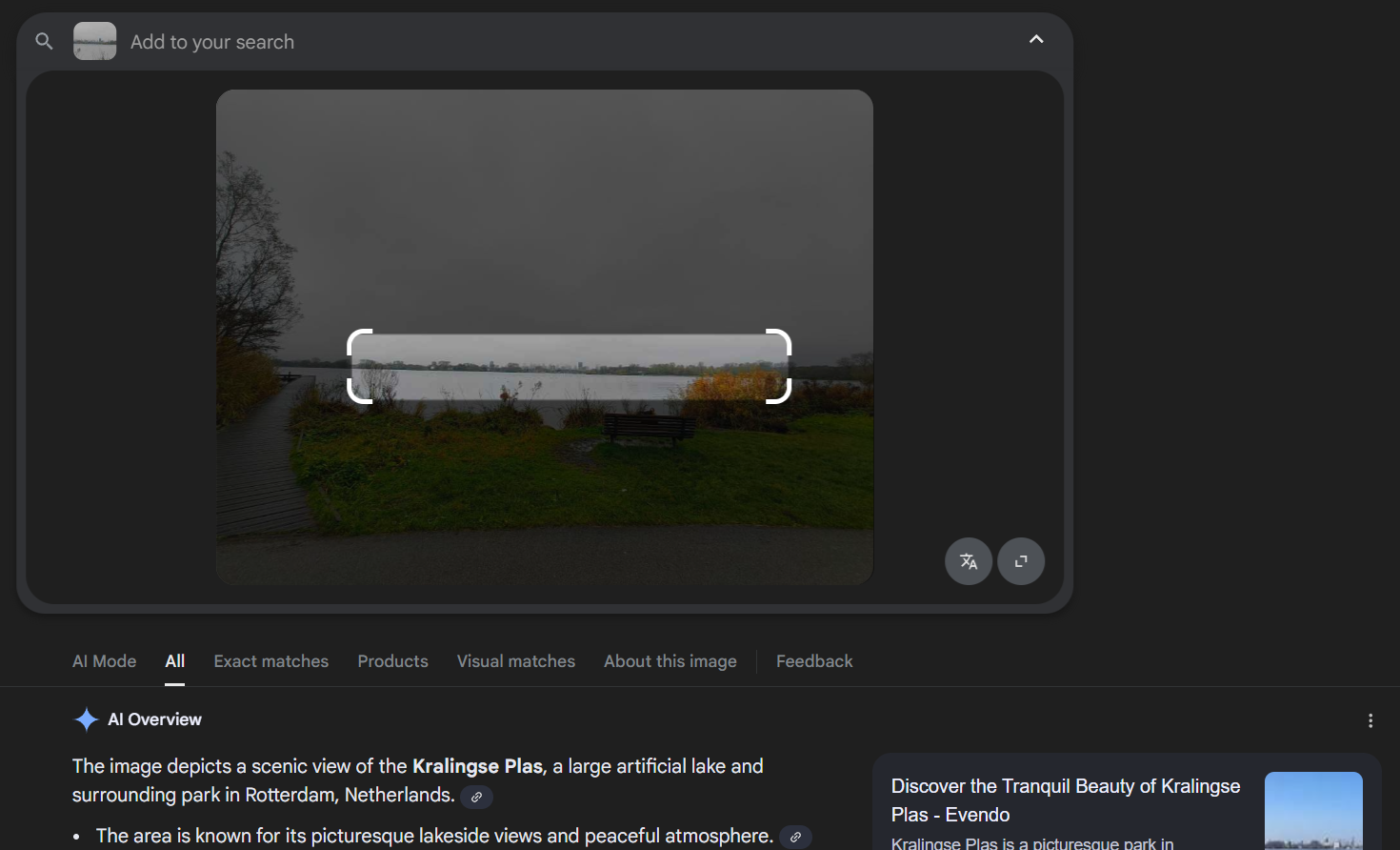
Instead of searching the whole image, we crop tightly around the distant buildings on the horizon and re-run the reverse image search.
💥 This is the breakthrough.
Suddenly we start seeing repeated references like:
- “Rotterdam, Netherlands”
- “Kralingse Plas”
When multiple unrelated sources point to the same name, that’s not coincidence — that’s signal.

Step 3: Pivot to Google Maps
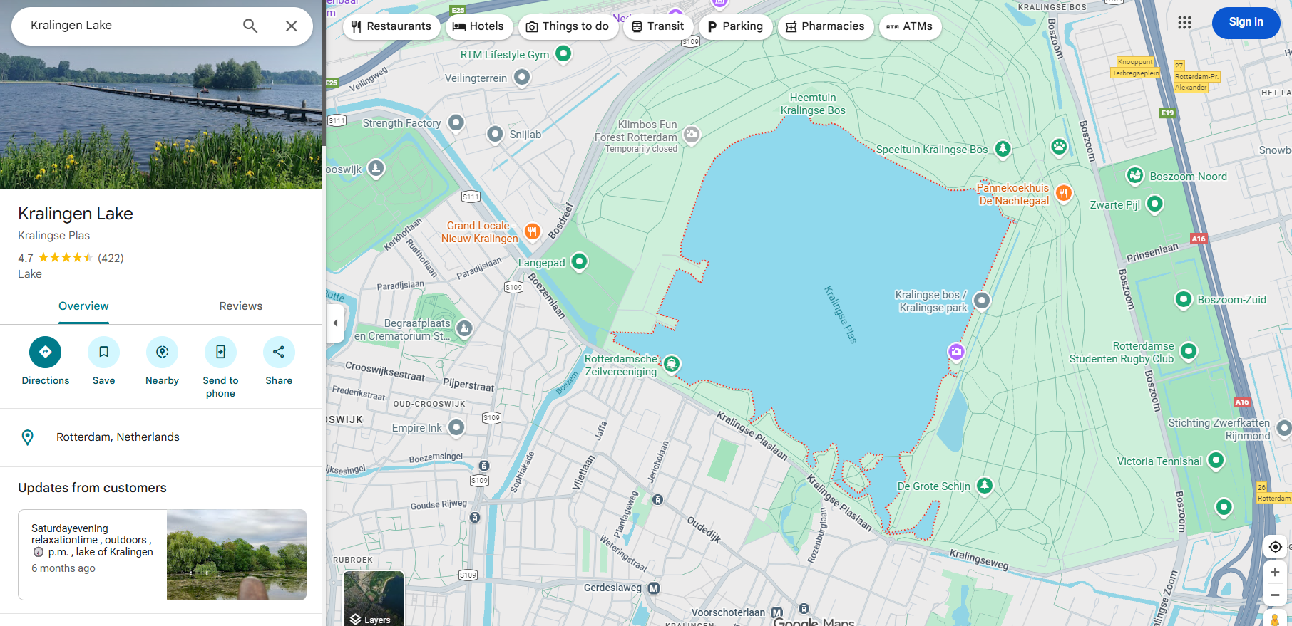
We now search for Kralingse Plas in Google Maps.
Immediately we notice:
- A large lake near the city
- Walking paths along the edge
- Residential and commercial buildings visible across the water
Visually, it’s already a strong match.
Step 4: Street View Verification
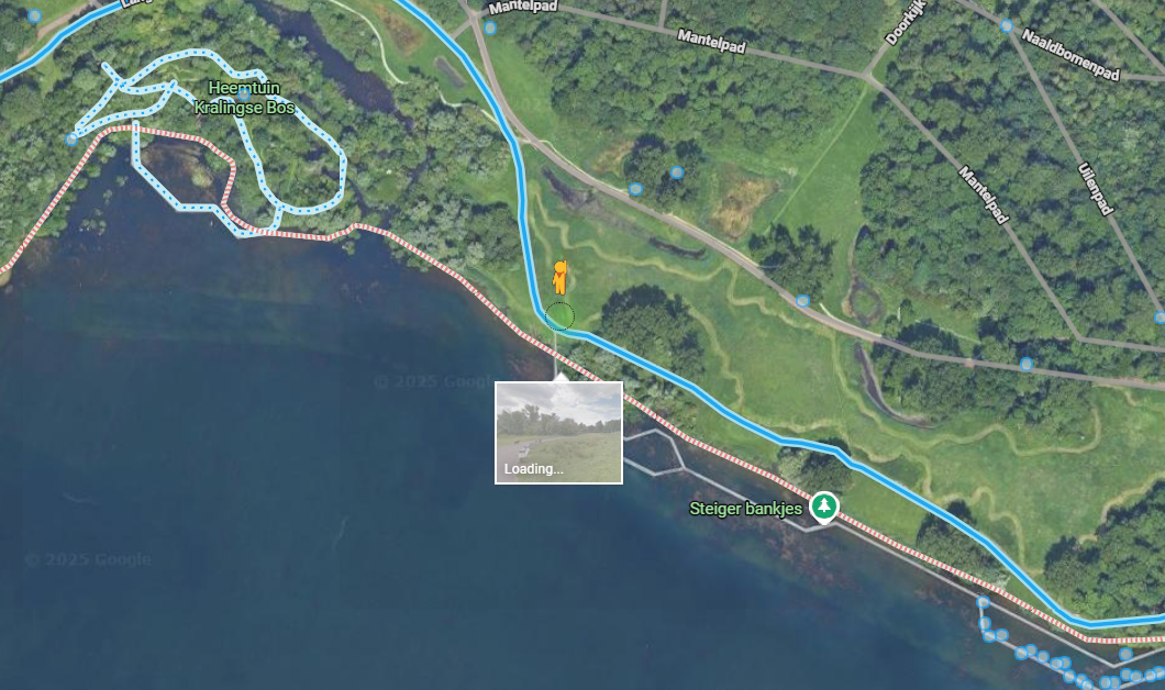
Next, we drop Pegman near the walking trail.
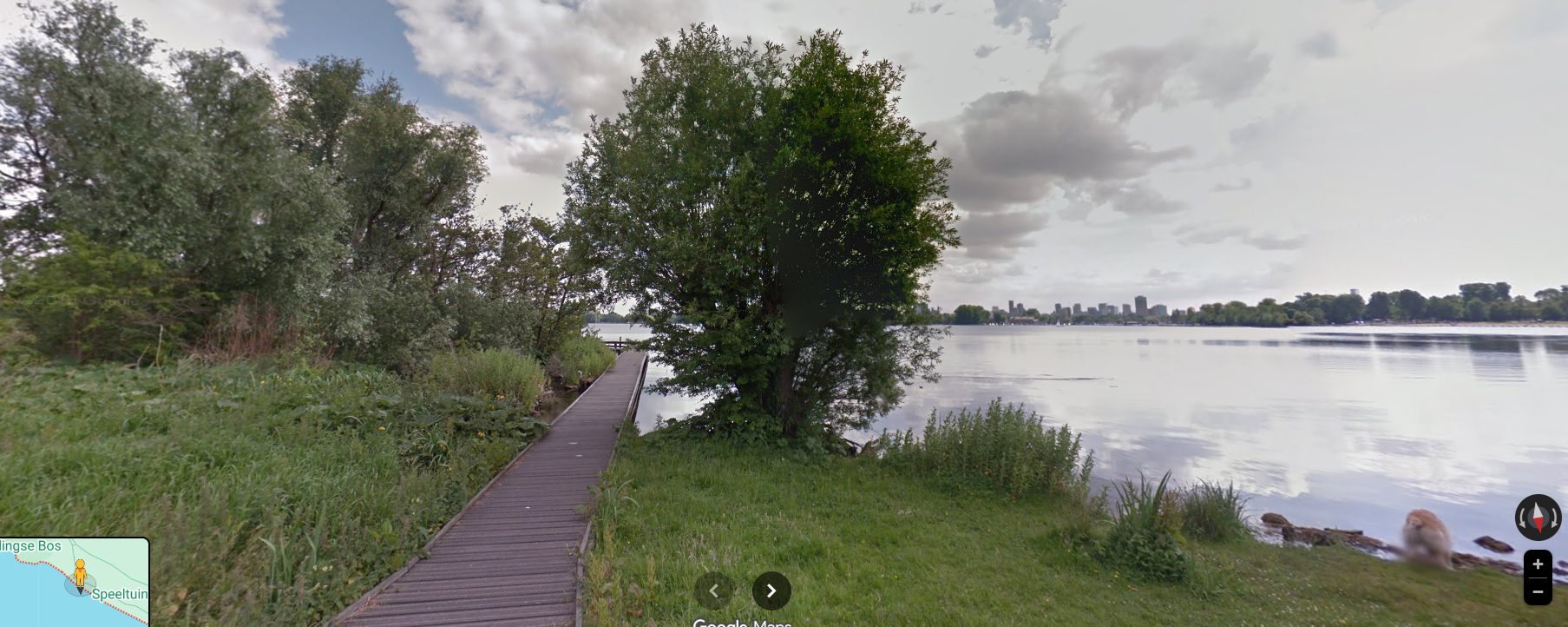
Here’s what confirms it:
- The same shoreline curvature
- A matching paved path on the left
- Distant skyline alignment
- Similar vegetation patterns
One detail looks different — a tree near the waterline — but trees grow, get trimmed, or removed over time. That’s normal and not a disqualifier.
🧊 Yeti Rule #2: Structures are stronger evidence than foliage.
At this point, we can confidently say:
This image was taken at Kralingse Plas.
Step 5: Extracting Geographic Coordinates
To get coordinates for a large body of water:
- Zoom to the approximate center of the lake
- Right-click → What’s here?
- Copy the latitude and longitude
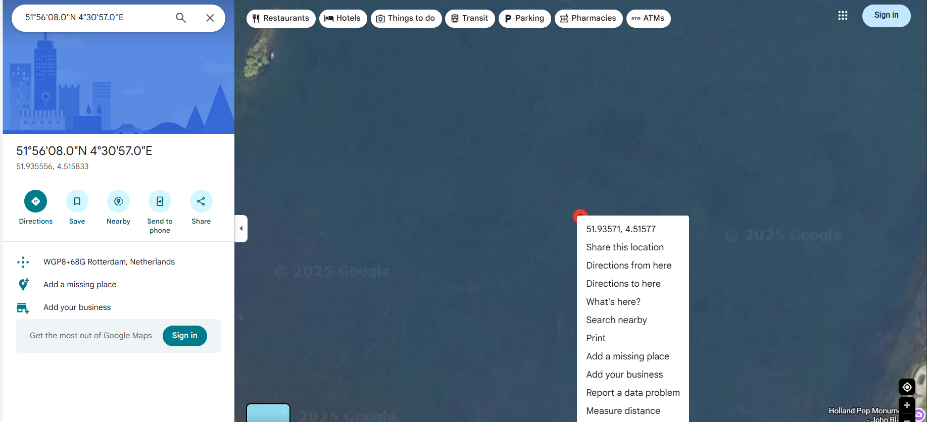
⚠️ Note:
For large features like lakes, coordinates are approximate, not a single exact point. That’s acceptable unless the challenge specifies otherwise.
Final Answer: Kralingen Lake, Rotterdam, Netherlands 51°56'08"N 4°30'57"E
Why This Is Important
This challenge teaches several core OSINT skills:
- Cropping and reframing images
- Prioritizing background context over foreground subjects
- Verifying locations using multiple independent sources
- Understanding the limits of coordinate precision
Real investigations often start with worse images than this.
Final Thoughts from the Yeti
This was a textbook example of:
“There’s always more information — you just haven’t zoomed in the right place yet.”
Great challenge, clean pivot, solid confirmation.
Another one iced and bagged.
Stay curious. Stay methodical.
404Yeti out. 🐾❄️