Trace Labs Challenge #6

Hey everyone — 404Yeti here, strapping in for another Trace Labs OSINT challenge. This one’s a fun mix of aviation tracking, social media pivoting, and geospatial verification.
Objective
Question:
What airport did Elon Musk’s private jet (Tail # N628TS) land at on September 19, 2025?
This is a great challenge because it will utilize a few things: how to track aircraft, how to use two sources to verify and pivot
Tools Used
- X (Twitter) – initial social media intelligence
- ADS-B Exchange – aircraft tracking & historical flight data
- Google Earth – geospatial visualization and final confirmation
Why This Is a Great Challenge
This task forces you to practice a critical OSINT skill:
Pivoting when a lead goes cold.
We’re not just tracking a plane — we’re learning how to:
- Correlate social media claims with raw data
- Verify third-party tracking information
- Move from text → telemetry → satellite imagery
Step 1: Initial Research (Search + Social Media)
We’re given a tail number: N628TS — that’s our anchor.
So i started to google his aircraft number
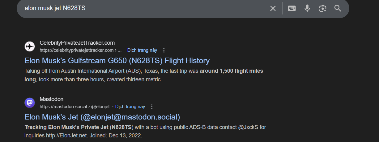
This quickly surfaced multiple references to aircraft-tracking discussions and social accounts. One that stood out was the well-known jet-tracking community account commonly referred to as “ElonJet” (active across platforms).
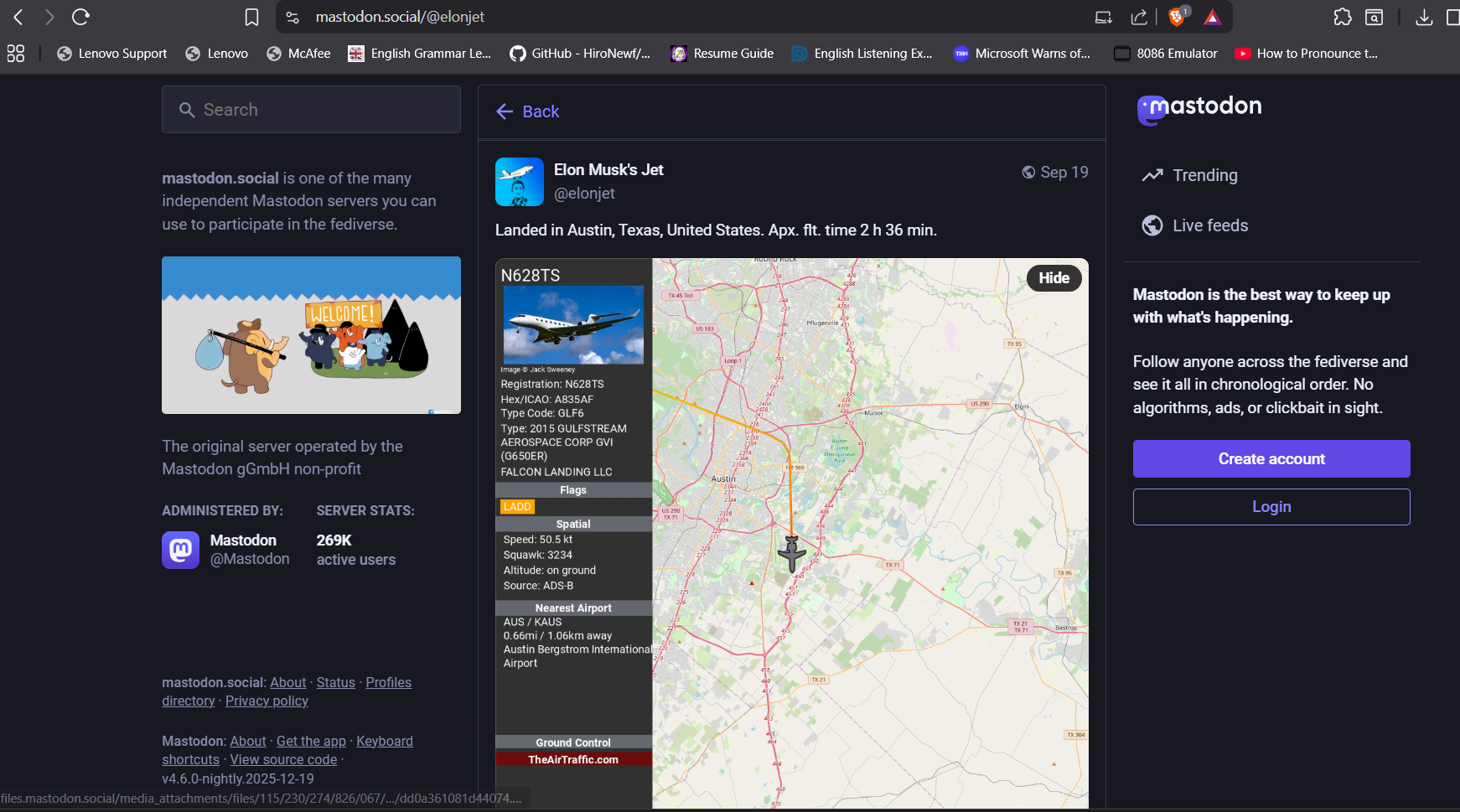
From a September 19th post, the claim was:
Elon Musk’s jet landed in Austin, Texas
That’s a strong lead — but OSINT rule #2 applies:
Social media is a clue, not a conclusion.
We need to verify this independently.
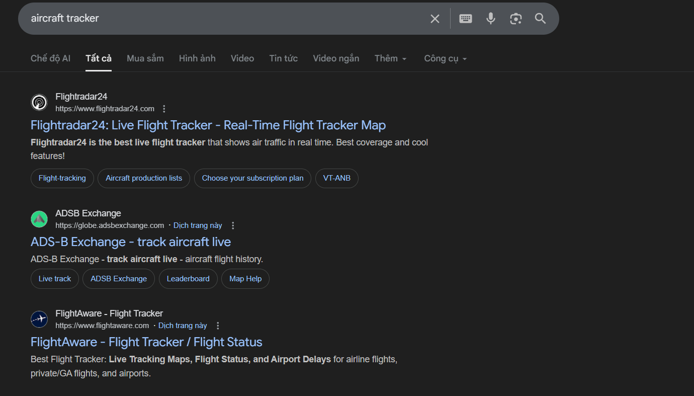
So lets google. Aircraft tracker
Dead End (and Why That’s OK)
The post referenced TheAirTraffic.com, which should have been useful — but in this case, it didn’t provide the confirmation we needed.
Important lesson:
- Dead ends are not failures
- They’re signals to pivot, not stop
So… we pivot.
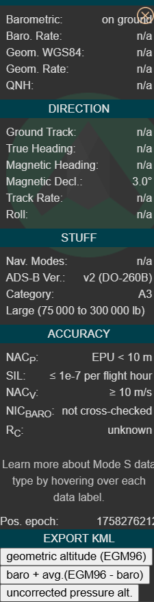
Step 2: Aircraft Tracking with ADS-B Exchange
Next, I searched for a reliable aircraft-tracking platform and selected ADS-B Exchange, because:
- It provides raw, uncensored ADS-B data
- It supports historical flight replay
- It allows KML exports for mapping tools
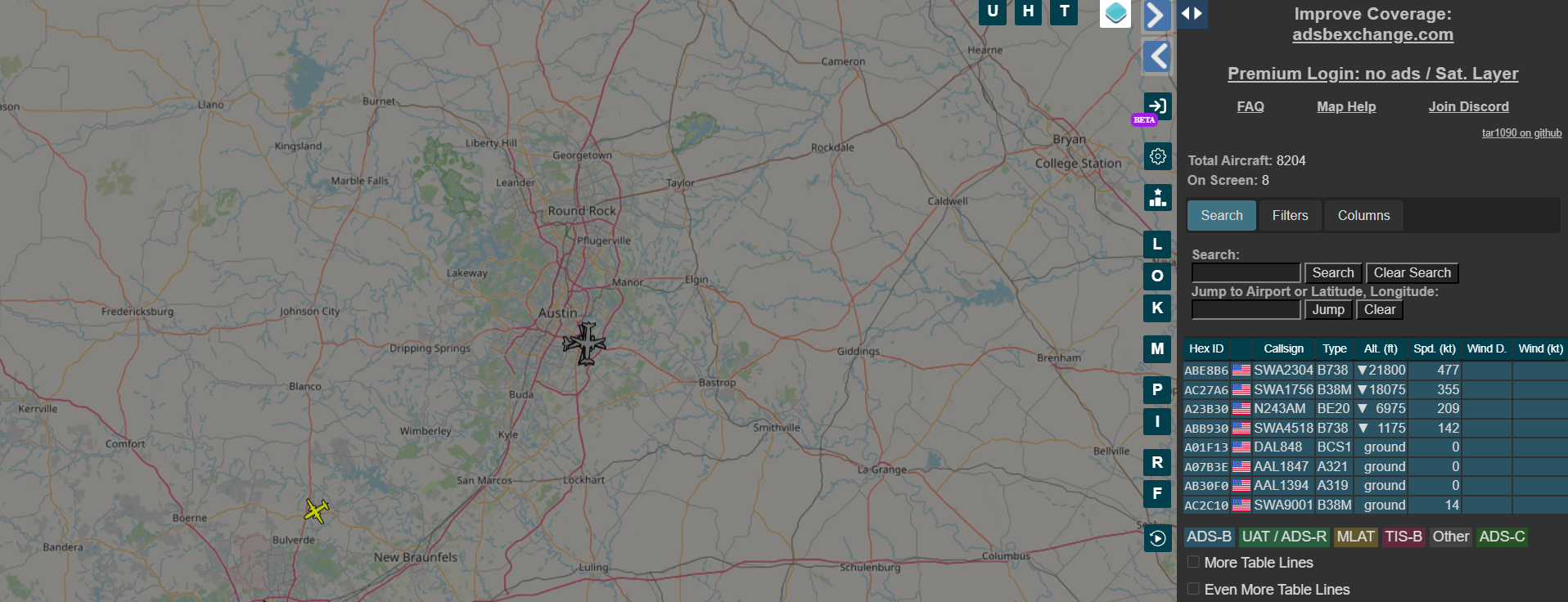
so we can check from the historical view that we can see elon musk's does have data on 9-19-2025

next download the KML file from this trip
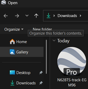
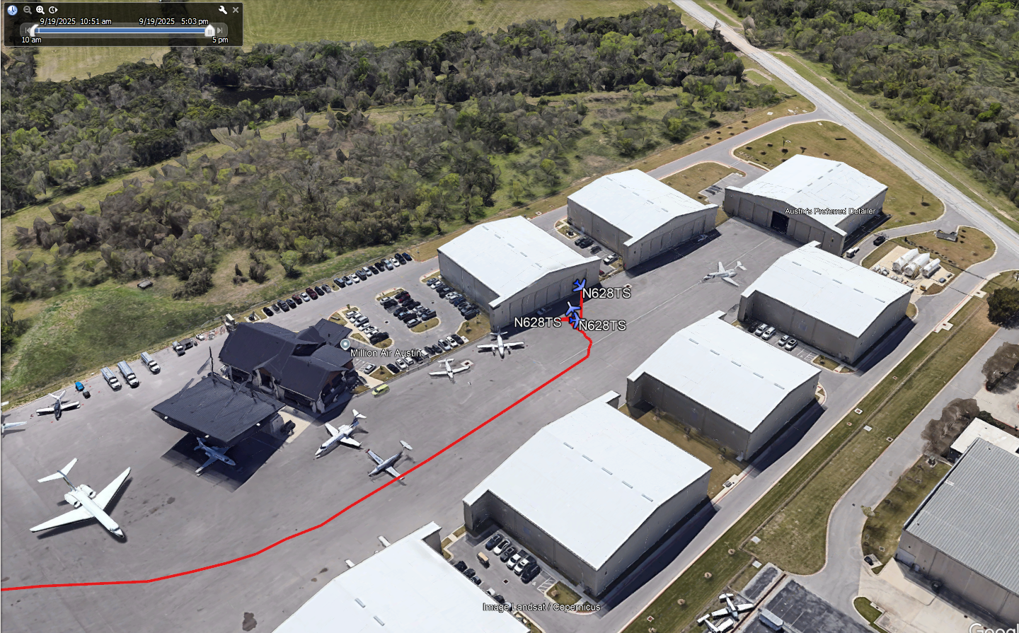
Step 3: Pivot to Google Earth (Visualization)
- Open Google Earth
- Import the KML file
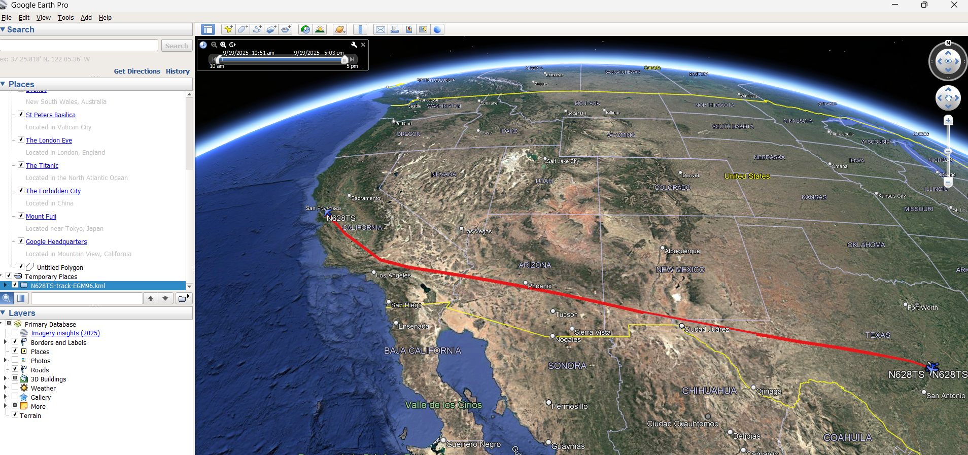
we can see the direct path the aircraft took.
lets zoom in and see where he went
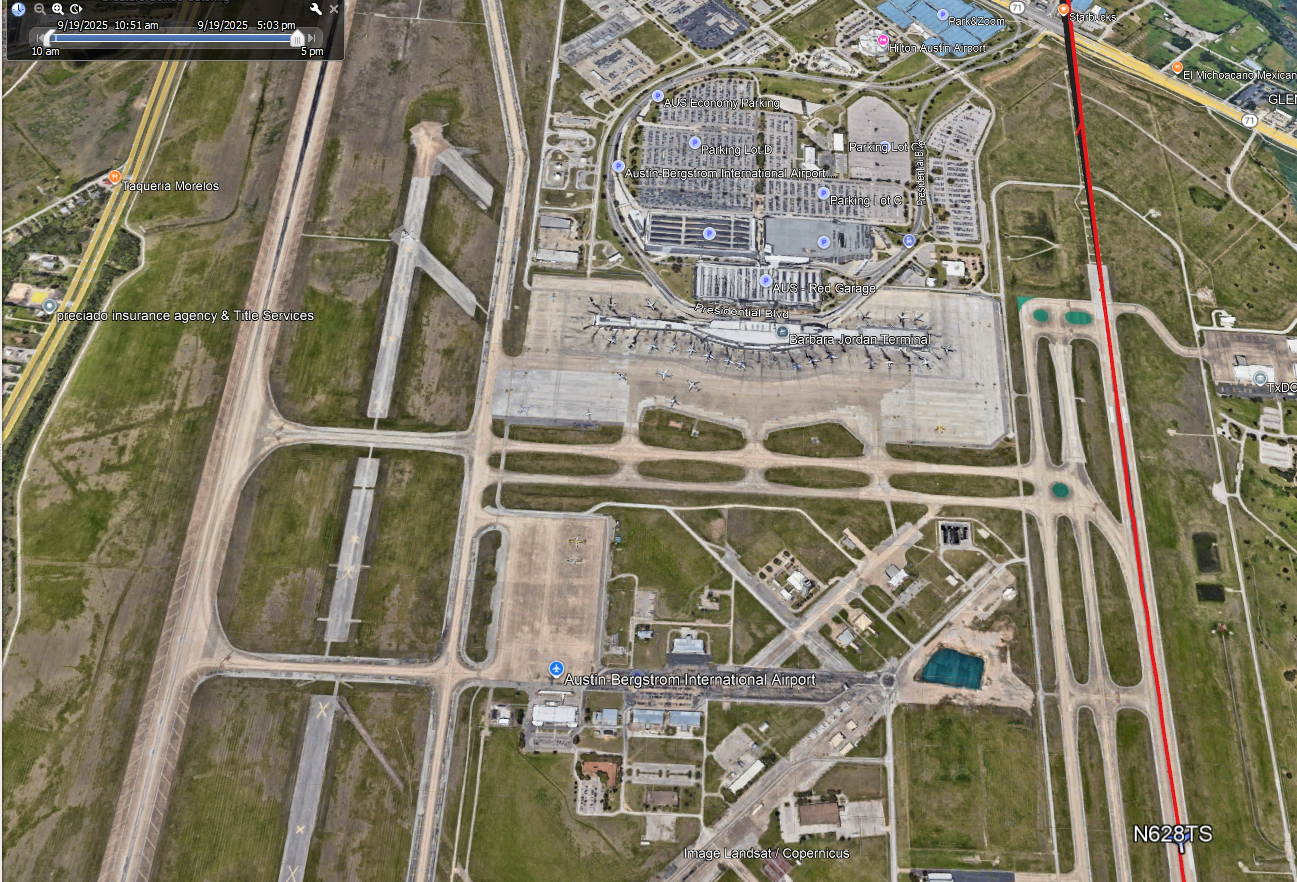
we can clearly see he is at Austin Bergstrom International Airport
Final Answer: Austin Bergstrom International Airport
Bonus OSINT Insight
If you follow the aircraft movement closely in Google Earth, you can:
- Identify specific hangar areas
- Observe taxi patterns
- Narrow down likely FBOs used by private jets
It won’t give you an exact hangar number — but with deeper OSINT (business records, FBO tenants, historical photos), you could go further.
Why This Matters
This challenge perfectly demonstrates a real investigative workflow:
- Pivoting after a failed lead
- Verifying social claims with raw data
- Combining text, telemetry, and imagery
- Not stopping at the first answer
Many investigators fail not because they lack tools — but because they give up too early.
Final Thoughts from the Yeti
OSINT isn’t about being fast.
It’s about being correct, repeatable, and defensible.
When one trail freezes over, you don’t stop — you find another slope down the mountain.
Stay frosty.
Stay methodical.
404Yeti out. 🐾🧊