Trace Labs Challenge #4
Hey everyone — 404 Yeti here, wrapping up the fourth Trace Labs OSINT Challenge! ❄
This one takes us high above the snow clouds into one of the most recognizable skylines in the world — but getting there required some sharp observation. Let’s break it down, step by step.
The Mission
Task: Identify the location shown in the provided image.
Goal: Recreate the exact viewpoint and name the location
Tools Used
- Google Image Search — to identify unique structures
- Google Maps + Street View — for matching perspective
Image:

Step 1. Use Google Reverse Image Search
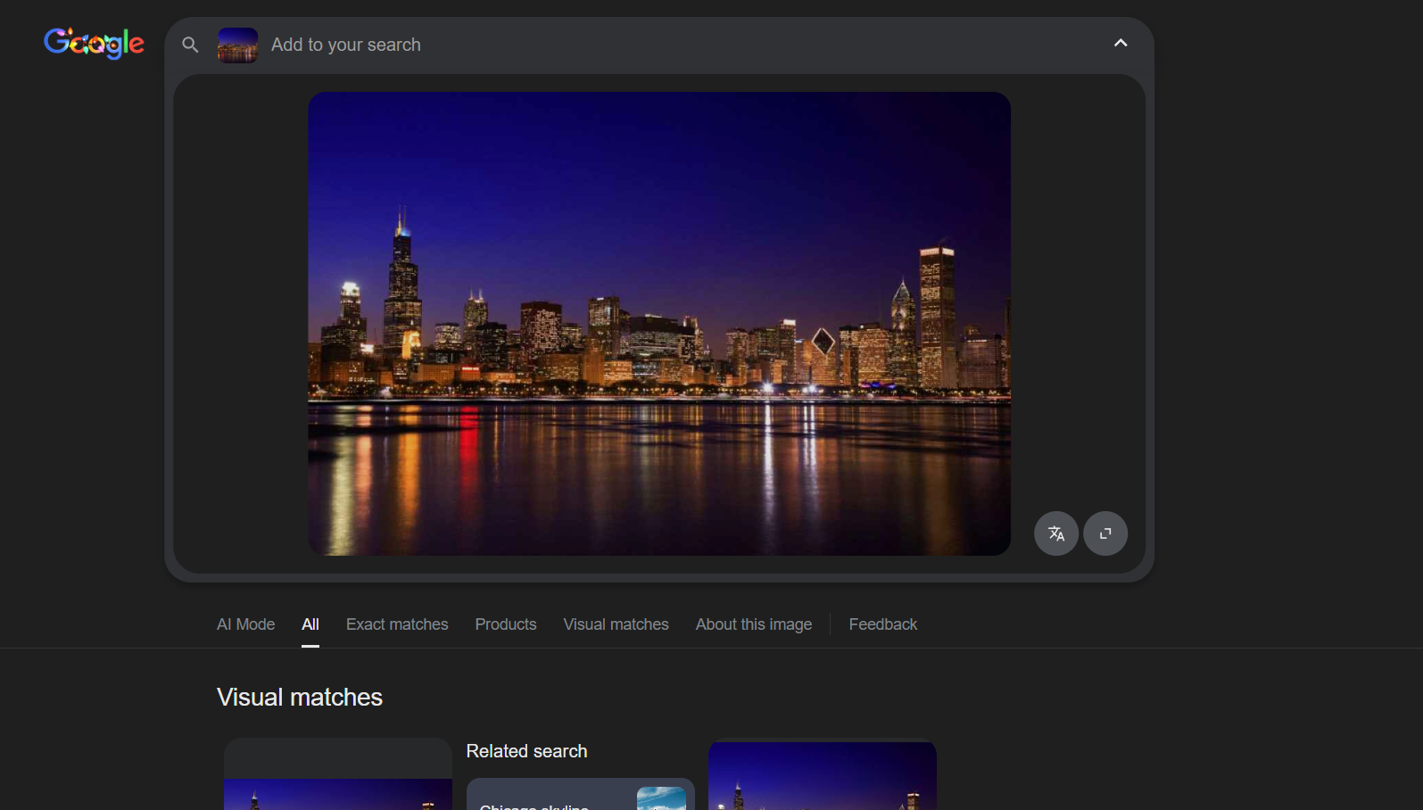
At first glance, this image looked like a generic city skyline — tall towers, reflections, and dense urban layout. Not easy!
I ran the image through Google Images and started zooming in on distinct shapes — particularly a diamond-shaped roof on one building.
💡 Yeti Tip: When skyline shots feel impossible, don’t search for the whole image — focus on a single unique building.
Step 2: Identify Key Landmark
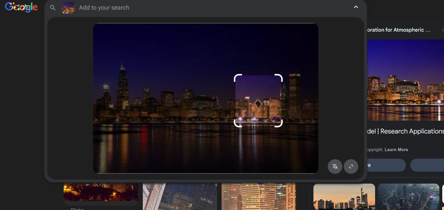
By isolating that diamond-shaped rooftop, the reverse search pointed me toward the Crain Communications Building.
That’s a major clue — time to verify it visually.
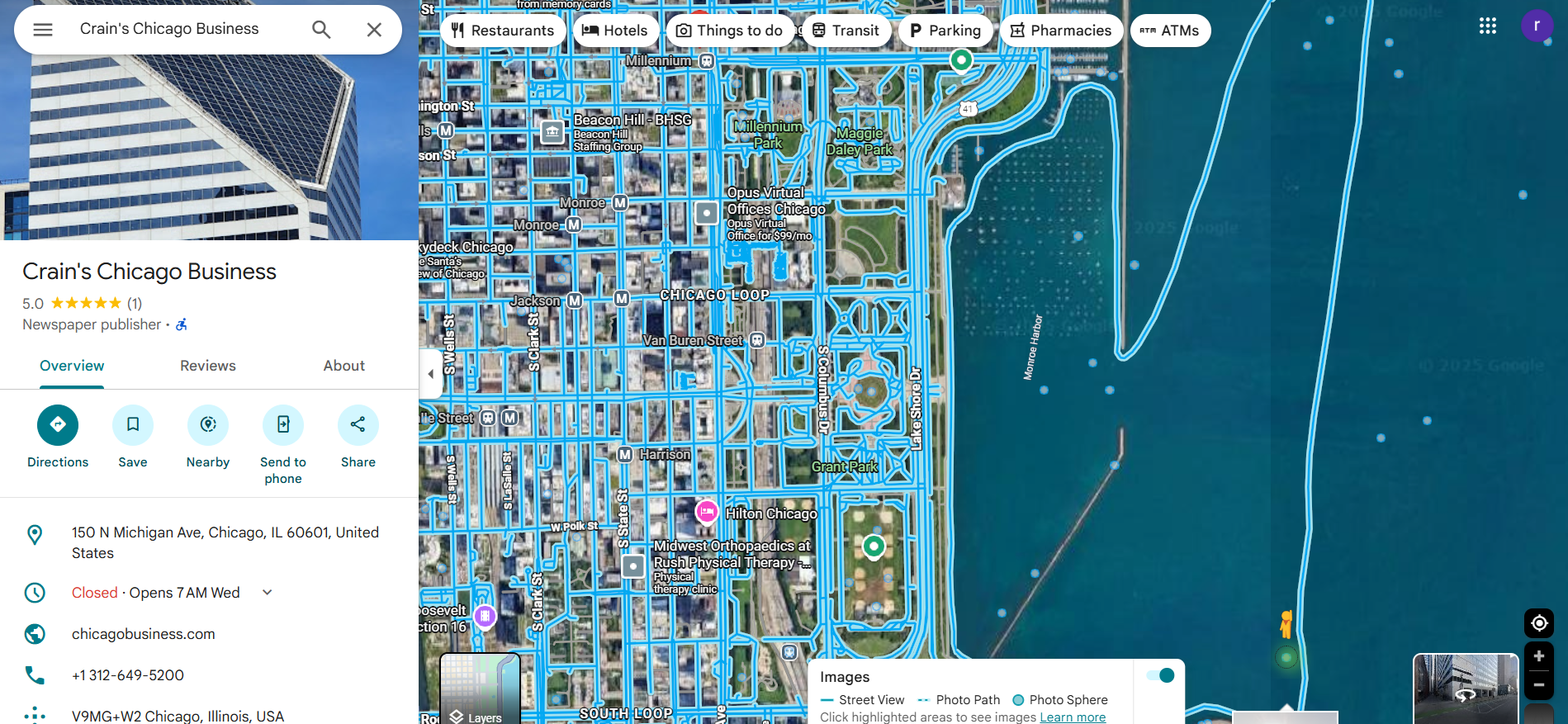
Step 3. Confirm with Google Maps
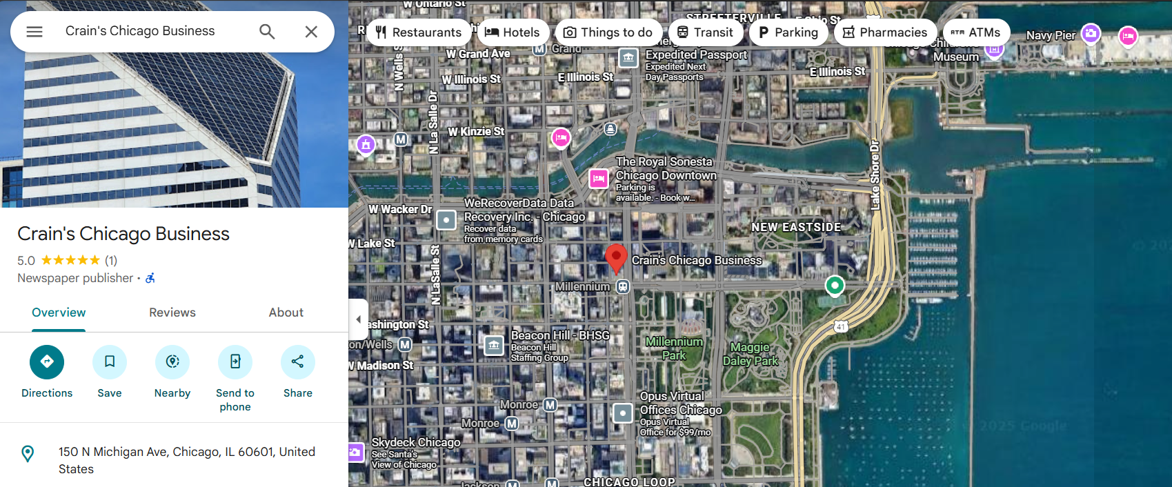
I jumped into Google Maps, searched for “Crain Communications Building,” and switched to 3D and Street View.
From this position, the surrounding buildings and lakefront perfectly matched the original image’s skyline.
To get even closer, I used Street View positioning to replicate the perspective — in the ocean
Step 4: Recreate the Photo
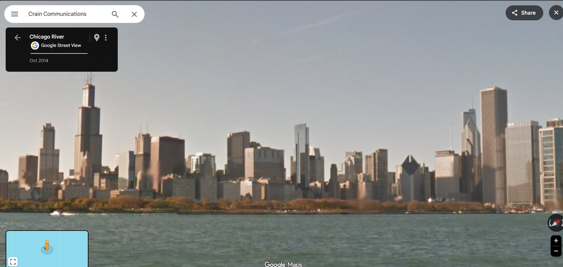
After some fine-tuning and zoom adjustments, the skyline alignment was almost identical — same rooftop angles, same light reflections.
Boom — it was the Chicago Skyline, confirmed beyond doubt.
Final answer: Chicago Skyline, Illinois, USA
Why is this important?
This challenge teaches an essential OSINT skill: recognizing unique identifiers in dense visual environments.
When faced with a busy scene, focus on what stands out — a shape, color pattern, or architectural feature — and build your search around that.
In real investigations, this approach helps when verifying urban photos, protests, or public footage.
“Every skyline has a fingerprint — you just need to find the ridge line.” — 404 Yeti
Final Thoughts:
The Chicago challenge tested our patience and precision, but it also reminded us how powerful visual OSINT can be when combined with geolocation tools.
It’s not just about finding the right city — it’s about proving it beyond any reasonable doubt.
Stay curious, stay precise, and stay frosty.
Yeti out. 🐾