How to Find a location from a single photo
Course Objectives
By the end of this module, you will be able to:
- Define Geospatial Intelligence (GEOINT).
- Identify visual clues in an image to aid geolocation.
- Use reverse image search, mapping tools, and metadata extraction to pinpoint a location.
- Cross-verify your findings for accuracy.
- Understand the ethical and privacy considerations when conducting GEOINT.
Hey everyone! Welcome to the GEOINT course! Today, we will be learning how to find a location with a single photo!
But first, I need to teach you a little bit about what GEOINT is
What is Geoint?
GEOINT (Geospatial Intelligence) is the art and science of determining where something is and extracting useful information from visual sources — often photos.
If Sherlock Holmes had Google Maps and a decent Wi-Fi connection, he’d be doing this all day.
As Yeti 404, I’ve used GEOINT everywhere — from finding missing hikers to confirming where a mysterious snow footprint came from. You’ll be using similar skills to analyze, search, and verify locations using publicly available information.
How do we perform GeoINT?
- Visual reconnaissance
- Scan the image carefully. Look for landmarks, building shapes, road signs, street signs, terrain features, vegetation patterns, or even shadows for time-of-day clues.
- Think big: mountains, coastlines, and skyline outlines are more helpful than “that one slightly suspicious pigeon.”
- Reverse image search
- Use Google Image Search or Yandex to find visually similar photos.
- Compare the matches: sometimes you’ll get the exact location; sometimes you’ll just get a lead.
(Yeti Tip: Sometimes Yandex is better for non-Western locations. It’s like having a cousin who travels more than you do.)
- Using Map and street view
- Open Google Maps and try to replicate the view from the image.
- Use Street View to adjust camera angles and see if the environment matches.
- When you find a likely match, right-click → Get coordinates for precise location data.
- Meta-Data Extraction
- Use tools like Exif data or Jimpl
- Look for GPS coordinates, camera model, or time/date info embedded in the file.
- Many platforms strip metadata automatically — but sometimes the gold nugget is still there.
- Cross Verification
- Always confirm findings with two or more sources.
- Example: match the Google Maps view and confirm with an official site, travel blog, or news photo.
Example
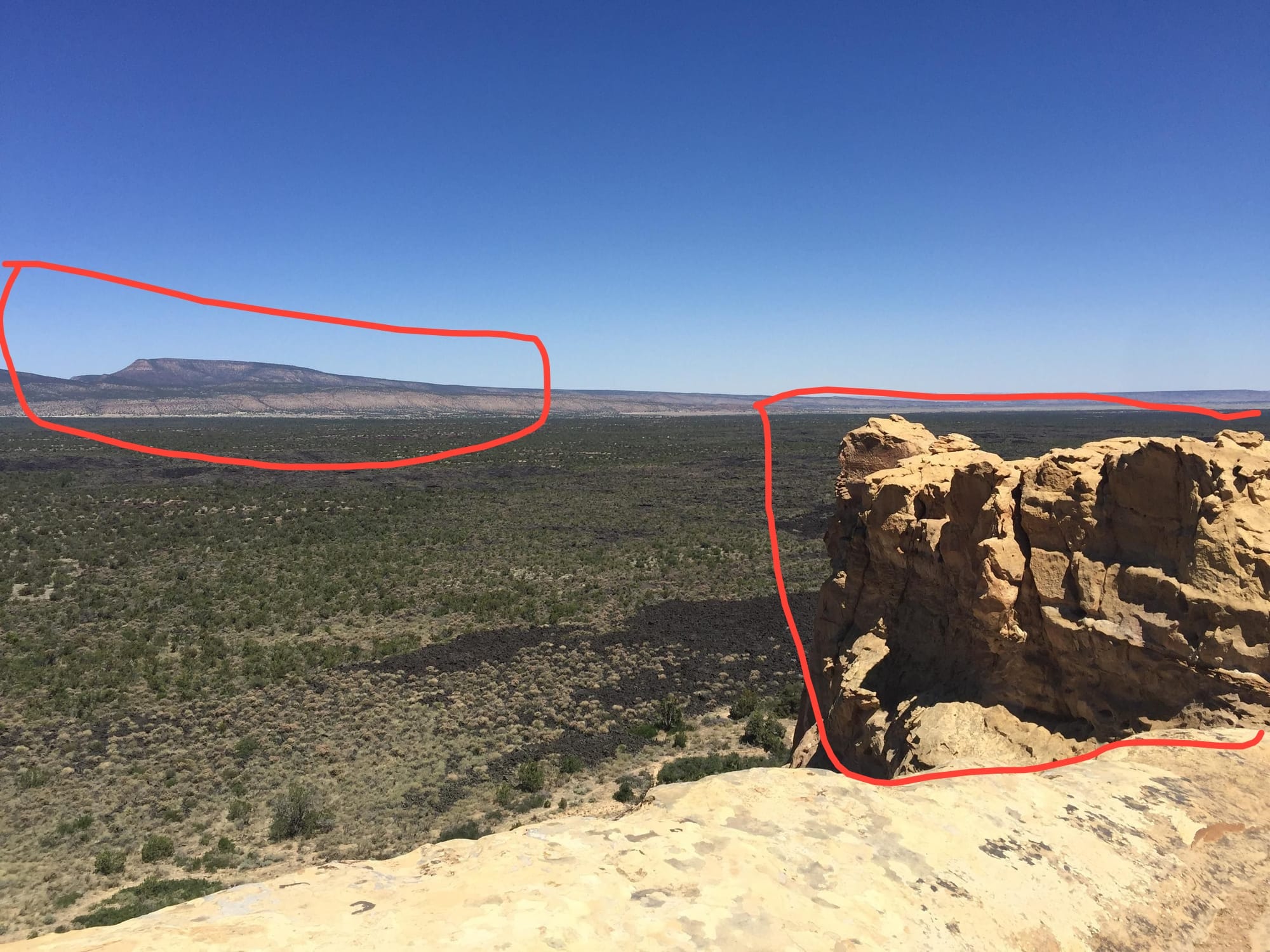
Lets try to find this location!
- Check the visuals
- We see mountains on the left side and a cliff on the right.
- This is a pretty basic photo, but we can do a lot with it.
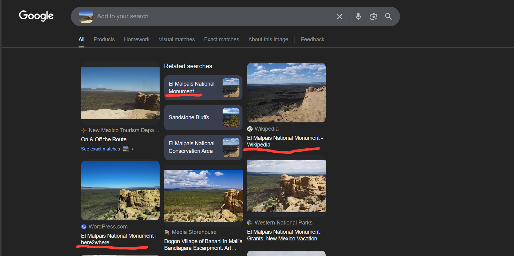
- Reverse Image Search
- Upload the image to images.google.com
- Start searching
- Use Google maps and street view
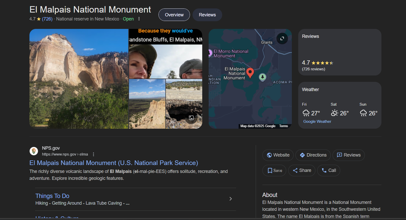
- From our Google search, we can already see a name "El Malpais National Monument"
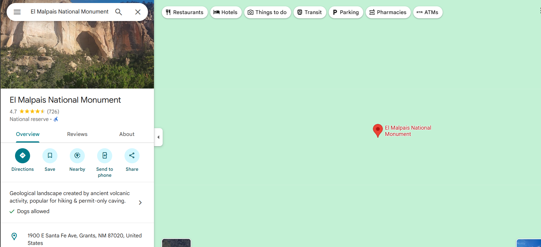
We see our result here on Google Maps.
Now use your hangman and throw him onto the monument
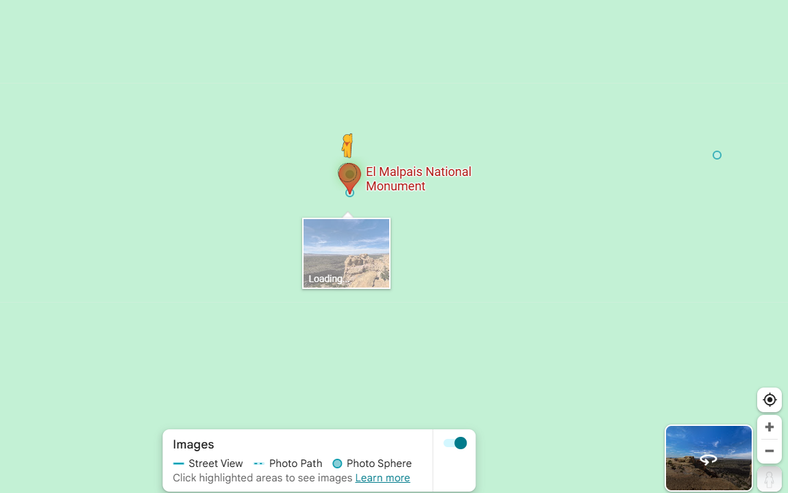
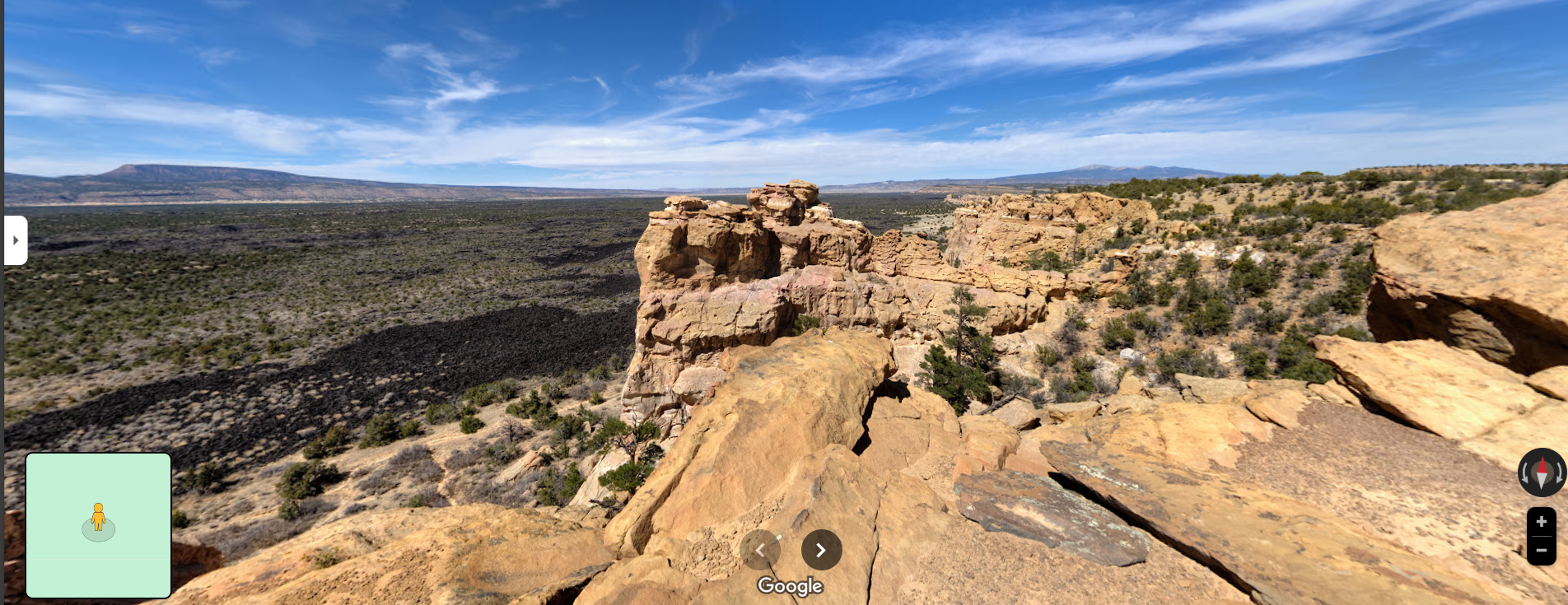
Now you can see we can replicate that pretty closely!
- Check to see if there is any metadata
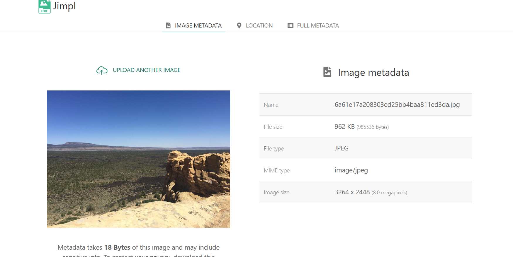
Now, if we wanted to, we could check the "Full Metadata" and see if there is any sensitive information.
- Cross Verification
- If you remember from our Google search, we had many hits for "EL Malpais National Monument." So we can do a quick Google search and find some official information, so we can say with confidence what the location is!
Tools Used:
- Google Maps/Street View
- Jimpl
So as you can see, there wasn't a lot of effort involved, despite being such a vague photo, so imagine something more sensitive...
Pro Tips for Beginners
- Focus on big features first — small details can mislead you.
- Blurry images? Ignore them unless they have one crystal-clear landmark.
- Street View is your best friend; learn to “walk” the streets like you own them.
- Always keep ethics in mind — just because you can find something doesn’t mean you should share it.
Final Thoughts
GEOINT is a skill that grows with practice. You’ll start with simple locations and work your way up to complex, multi-clue puzzles.
If I, a yeti with mittens too big for most keyboards, can track down a remote mountain pass from a single photo…
…then trust me, you can too.
Stay safe, stay curious, and remember — every pixel tells a story
Personally, I want to thank anyone who has taken this small mini course on learning Geoint. This is a big step for me, and I really hope you found this useful! Stay tuned for more mini courses like this!
Yeti Out!