Challenge 8
Hey everyone — 404Yeti back again, knocking out another Trace Labs OSINT walkthrough.
Today’s challenge is deceptively simple, but it teaches a huge lesson about not trusting the first answer you see.
Objective
Identify the zoo where this webcam image was taken
Tools Used
- Google Images — reverse image searching
- Google Search — webcam verification
- Google Maps / Street View — terrain and environment validation
Image:
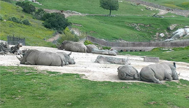
Initial Assessment
At first glance, this image is very vague:
- No visible signage
- No clear buildings
- Just animals, terrain, and fencing
This is exactly the kind of challenge where analysts can get misled if they rush.
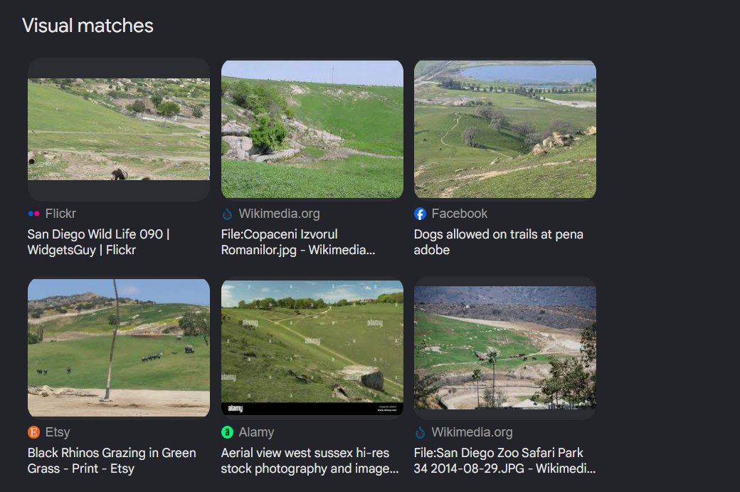
Step 1: Reverse Image Search
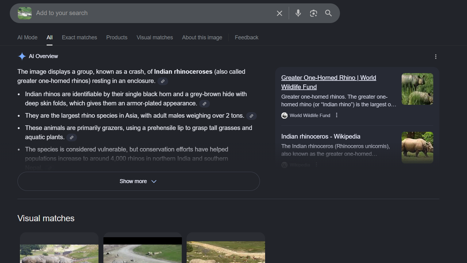
⚠️ Important Observation
The top results are heavily influenced by AI-generated descriptions, repeatedly identifying the animal as an:
Indian Rhinoceros
This is a great example of why:
❌ AI object recognition ≠ correct location
Animals can exist in many zoos, so species alone is not enough.
Step 2: Ignore the Animal, Analyze the Terrain
so we have a few choices to choose from but lets see if we can adjust the image to see if we can find something more clear
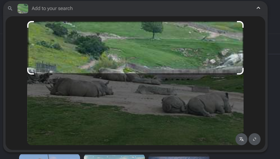
Instead of focusing on the rhinoceros, we shift attention to:
- Hills and elevation
- Vegetation type
- Trees and shrubs
- Enclosure layout
- Fencing style
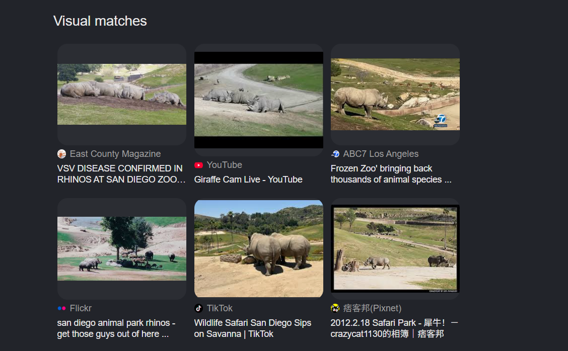
Scrolling further down the image results, we start seeing repeated mentions of:
San Diego Zoo
That’s our first real location-based clue.
Step 3: Pivot to Official Zoo Webcams
Rather than trusting image snippets, we search directly for:
I found there wasn't an exact match for a Rhino cam
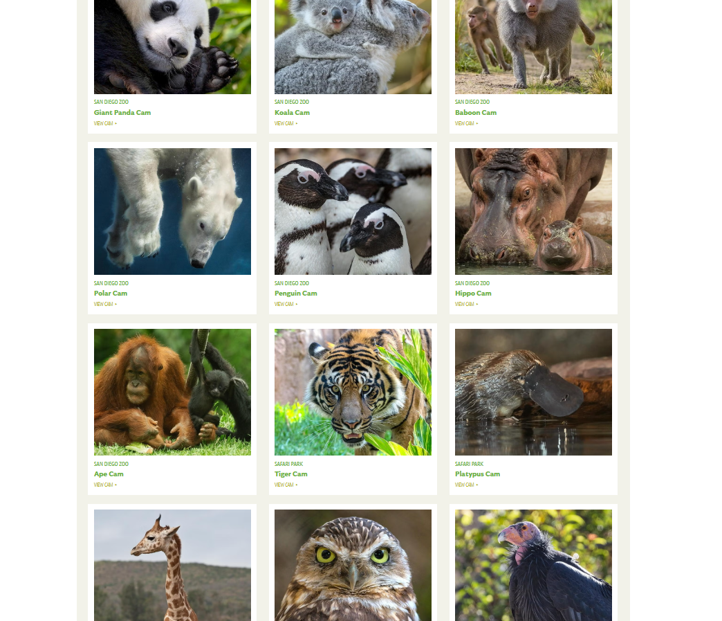
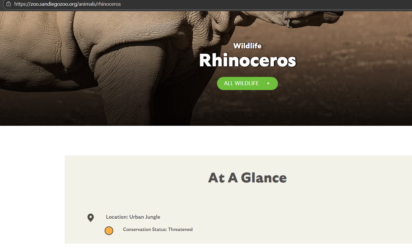
Upon looking at the rhino page, we dont see any webcam links but we do some area called Urban Jungle. This is probably outdated information since the terrain doesn't match the picture.
Step 4: Unexpected Pivot — Giraffe Cam

While browsing San Diego Zoo webcams, we stumble upon the giraffe cam.
This is the turning point.
Here we notice:
- Identical rolling hills
- Matching vegetation and shrub density
- Similar fencing style
- The same background terrain features
- And Of course the same Rhinos!
This is a quick win for us
Step 5: Terrain Verification with Maps
To be extra confident, we pivot to Google Maps and examine the area around the zoo.

Using satellite imagery and nearby viewpoints, we confirm:
- The hill silhouettes match
- The enclosure orientation aligns
- Tree placement and spacing are consistent
So lets do a streetcam view

So we can see a lot of similar terrain, and we can definitely see the similar hill tops, trees, and shrubs, so we can safely confirm that this is the San Diego zoo
Final Answer: San Diego Zoo, California, United States
Why This Is Important
This challenge highlights a critical OSINT lesson:
The subject of an image is often less important than its surroundings.
If we stayed locked onto “rhinoceros,” we would’ve:
- Hit a dead end
- Missed the correct location
- Drawn the wrong conclusion
Successful OSINT requires:
- Flexibility
- Environmental awareness
- Willingness to abandon a hypothesis when evidence doesn’t fit
Final Thoughts from the Yeti
OSINT isn’t about being fast — it’s about being right.
When clues stop lining up:
- Pivot
- Reframe
- Let the environment guide you
Another solid Trace Labs challenge down.
Stay observant, stay adaptable, and stay frosty. ❄️